
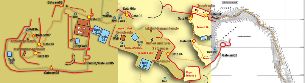
Layered CAD Map of Kavaledurga: Objects, Regions and Contour data as separate layers arranged
Layered CAD Map of Kavaledurga: Objects, Regions and Contour data as separate layers arranged as combinations based on map application and use.

Layered CAD Map of Kavaledurga: Objects, Regions and Contour data as separate layers arranged
Layered CAD Map of Kavaledurga: Objects, Regions and Contour data as separate layers arranged as combinations based on map application and use.